
Access Map
The Centre de Mathématiques Appliquées de l’X is located on the École Polytechnique campus, in the Laboratories Wing 0. The school is situated in the southern suburbs of Paris. You can reach it by RER train or by road.
GPS Coordinates:
📍 48.714269, 2.205630
📍 Google Maps: https://maps.app.goo.gl/6vEVuoCV5zLty8n26
Map
- Virtual access map
Transport and Access
Public Transport Access
There are two main access points: Massy-Palaiseau station or Lozère station.
From these stations, buses provide connections to the campus.
📌 Massy-Palaiseau Station (RER B)
- At the station, take Bus 4606 or 5154
- Get off at:
- "Place Marguerite Perey"
📌 Lozère Station (RER B)
- A 15-minute walk with approximately 300 steps
Access by Road
🚗 From Porte d’Orléans or Porte d’Italie → via the A6 motorway
🚗 From Pont de Sèvres → via N118
🔍 Check real-time traffic conditions
Nearby Airports
✈️ Orly Airport → via RER B and OrlyVal
✈️ Roissy-Charles de Gaulle Airport → direct via RER B
🛩️ Villacoublay Aerodrome
🛩️ Toussus-le-Noble Business Aerodrome
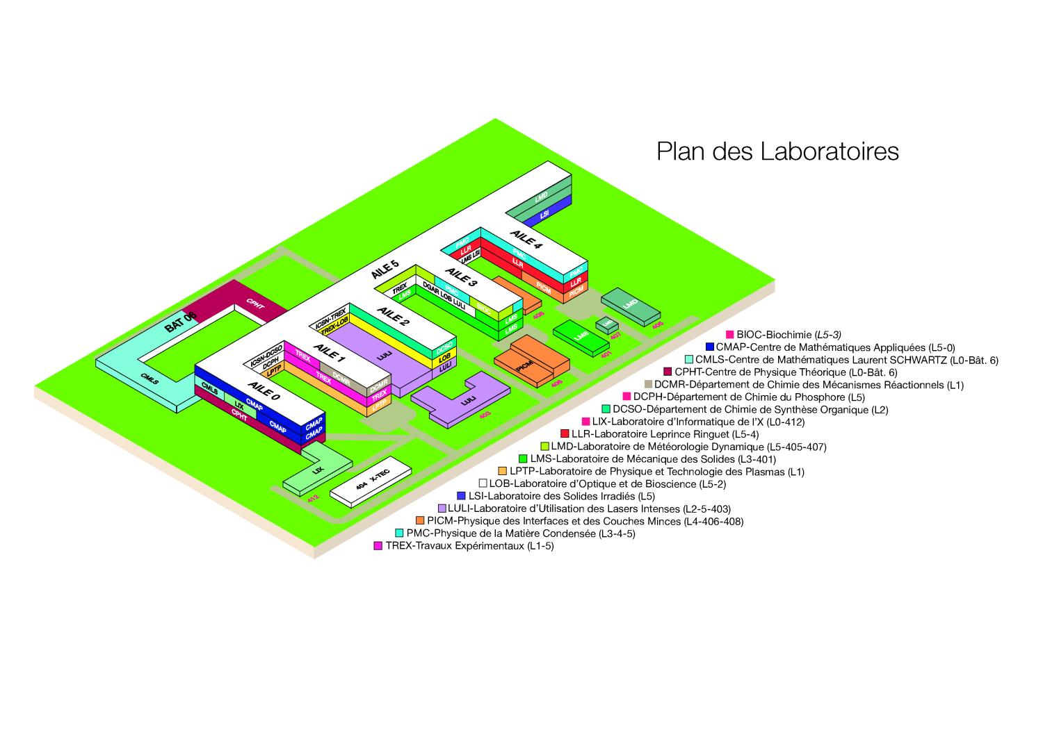
A campus map will help you find Wing 0, where we are located on the first and second floors.